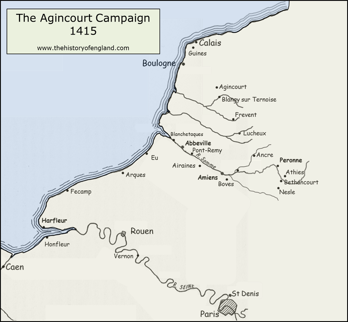
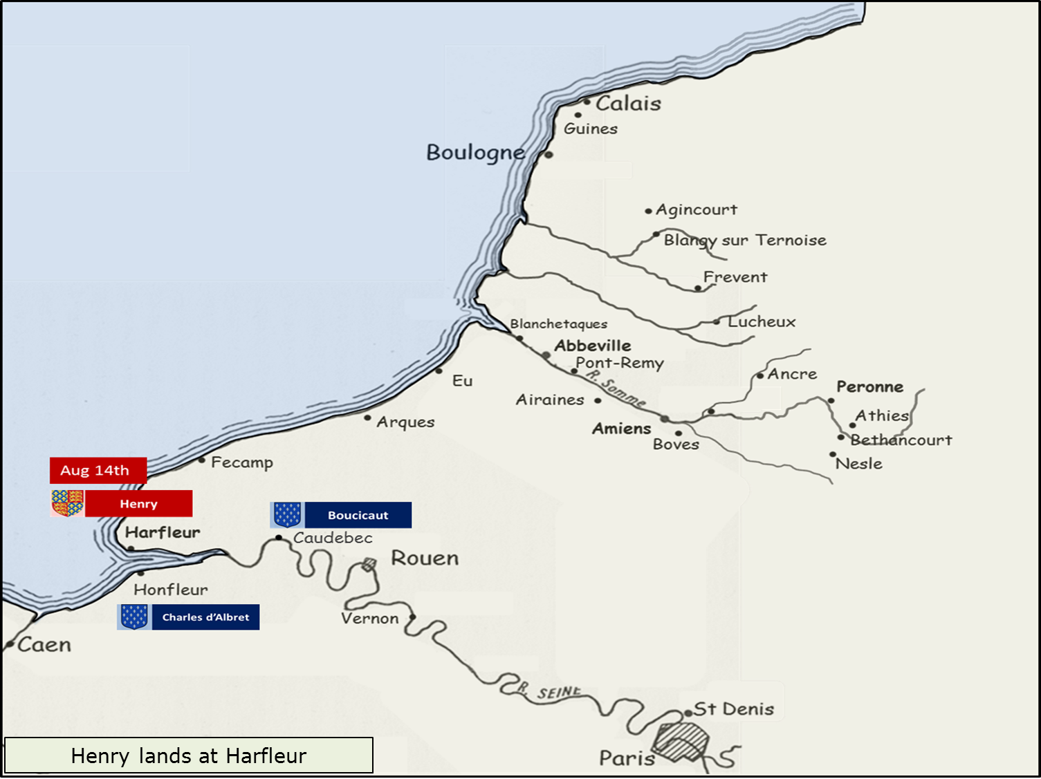
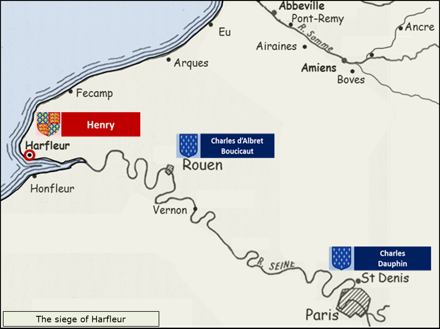
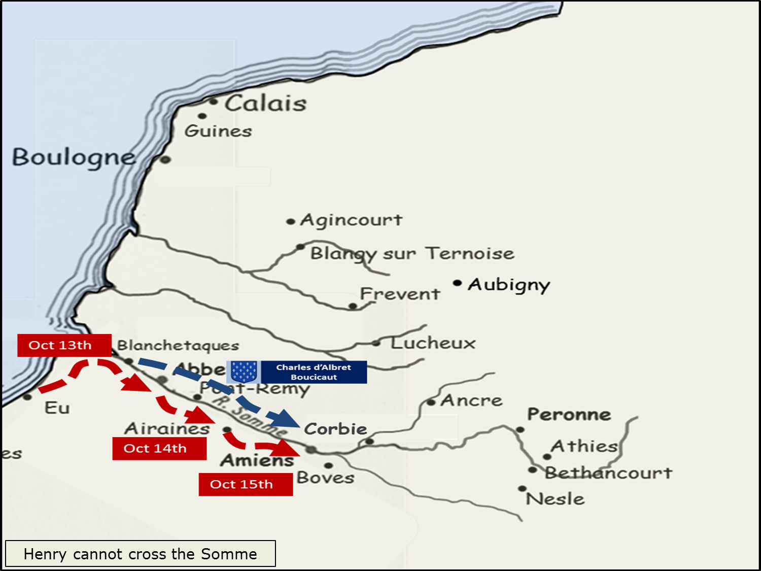
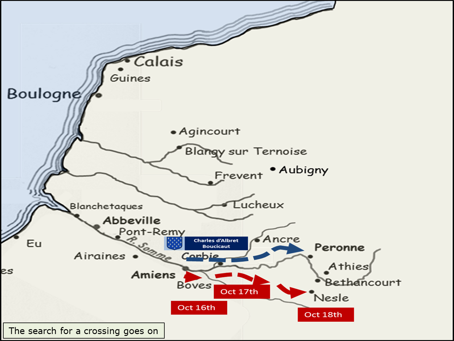
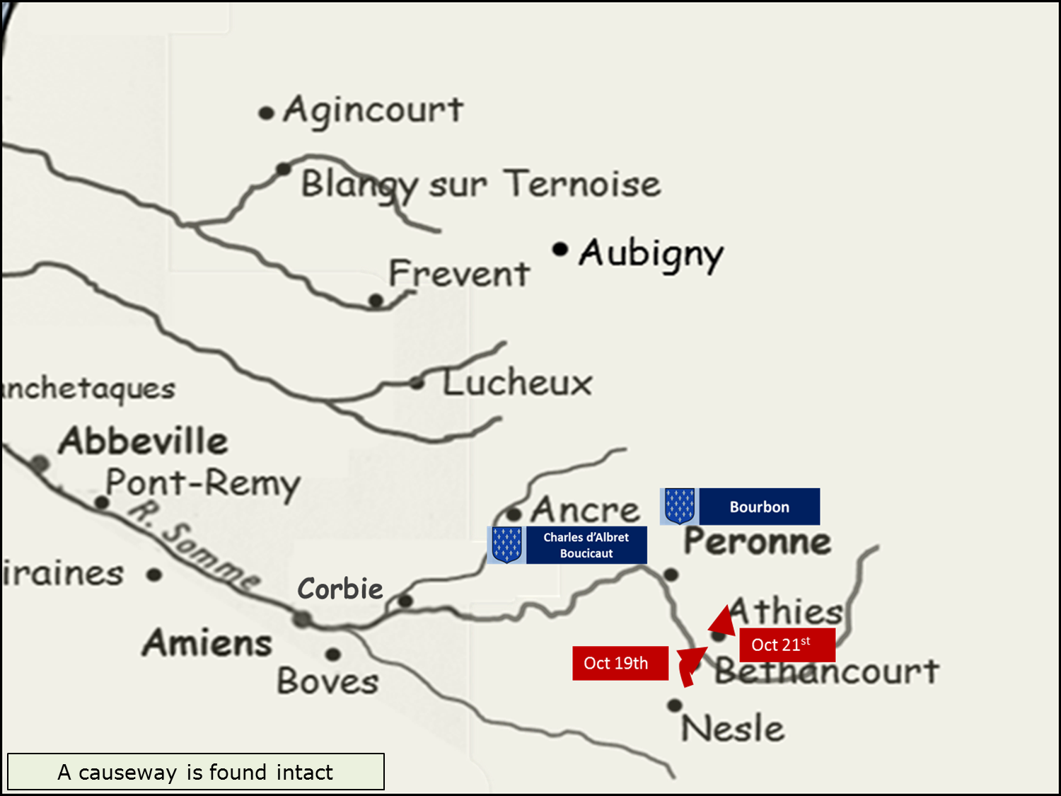
The Agincourt Campaign, 1415
You can let this animation run at it’s own speed, or click pause and then move the show on as you wish with the ‘next’ and ‘prev’ buttons. Grateful thanks to Andy Flaster and Jonathan Crowther for all the technology stuff. AND find our more on the podcast, episode 144 and episode 145.
Very helpful animated maps. Thank you. I am already about half way through the total number of episodes and beginning to panic. What happens when I fully catch and can only listen to one a week? Help! Maybe I will have to fill in with the history of English.
The history of English IS very good it must be said, so I can recommend that. Though if you are about halfway, you still have about 600,000 words and 63 hours of listening to go…but then, dare I suggest you could become a member! Cheap as chips! https://thehistoryofengland.co.uk/become-a-member/
Most importantly – anyone that compliments my animated maps is a friend for life.
I just started listening fairly recently, over here across the pond. I I enjoy the podcasts immensely, and the cool maps are most helpful
Thanks Robin. Maps took me ages – but were brilliant fun to do!
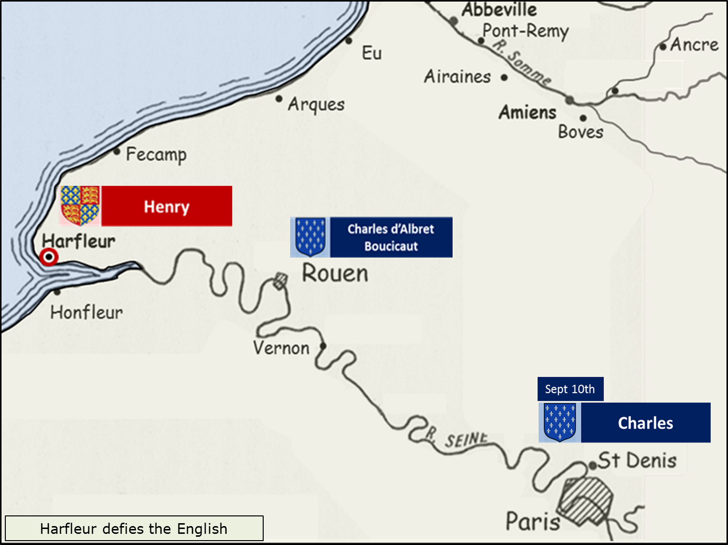
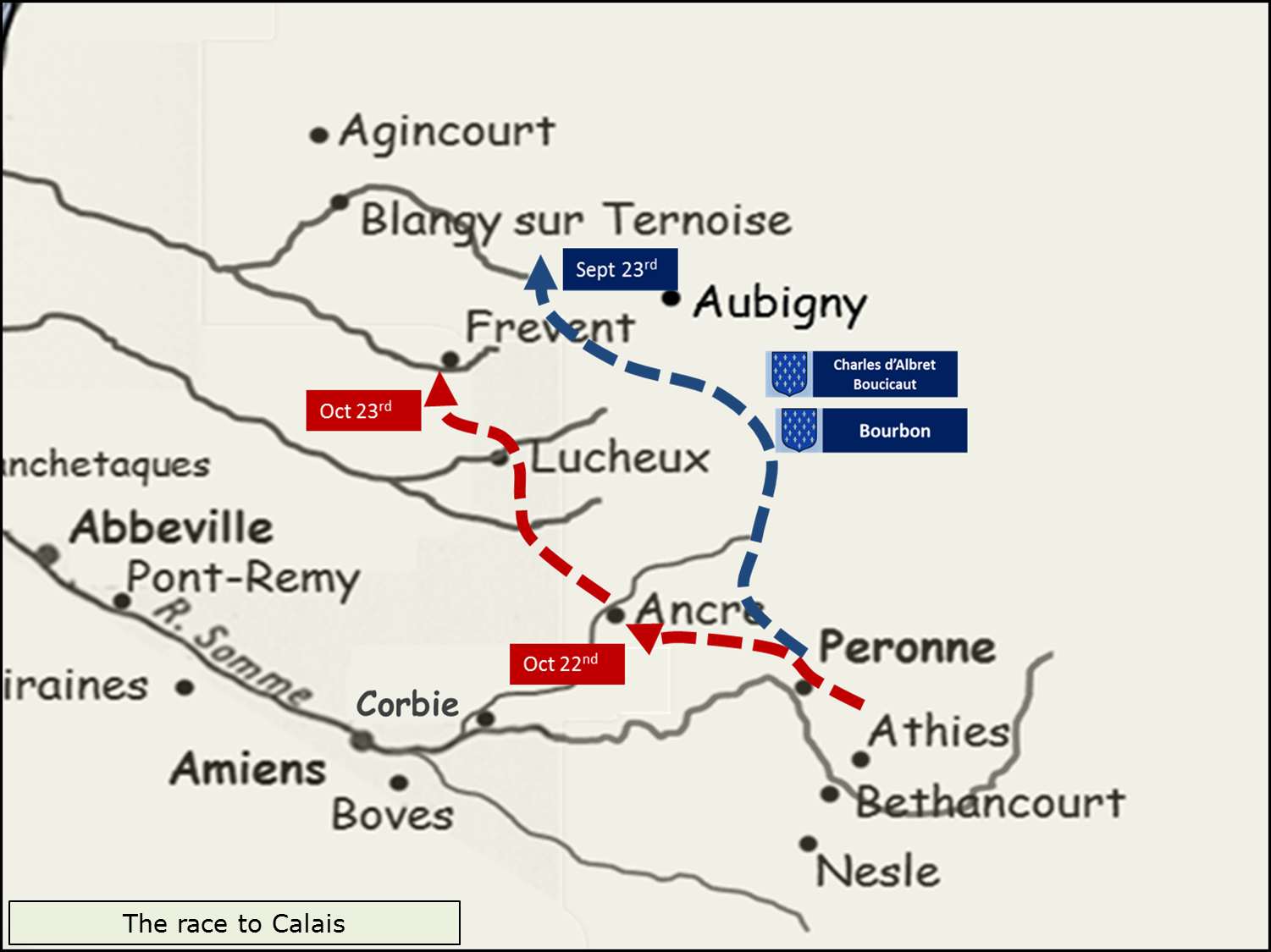
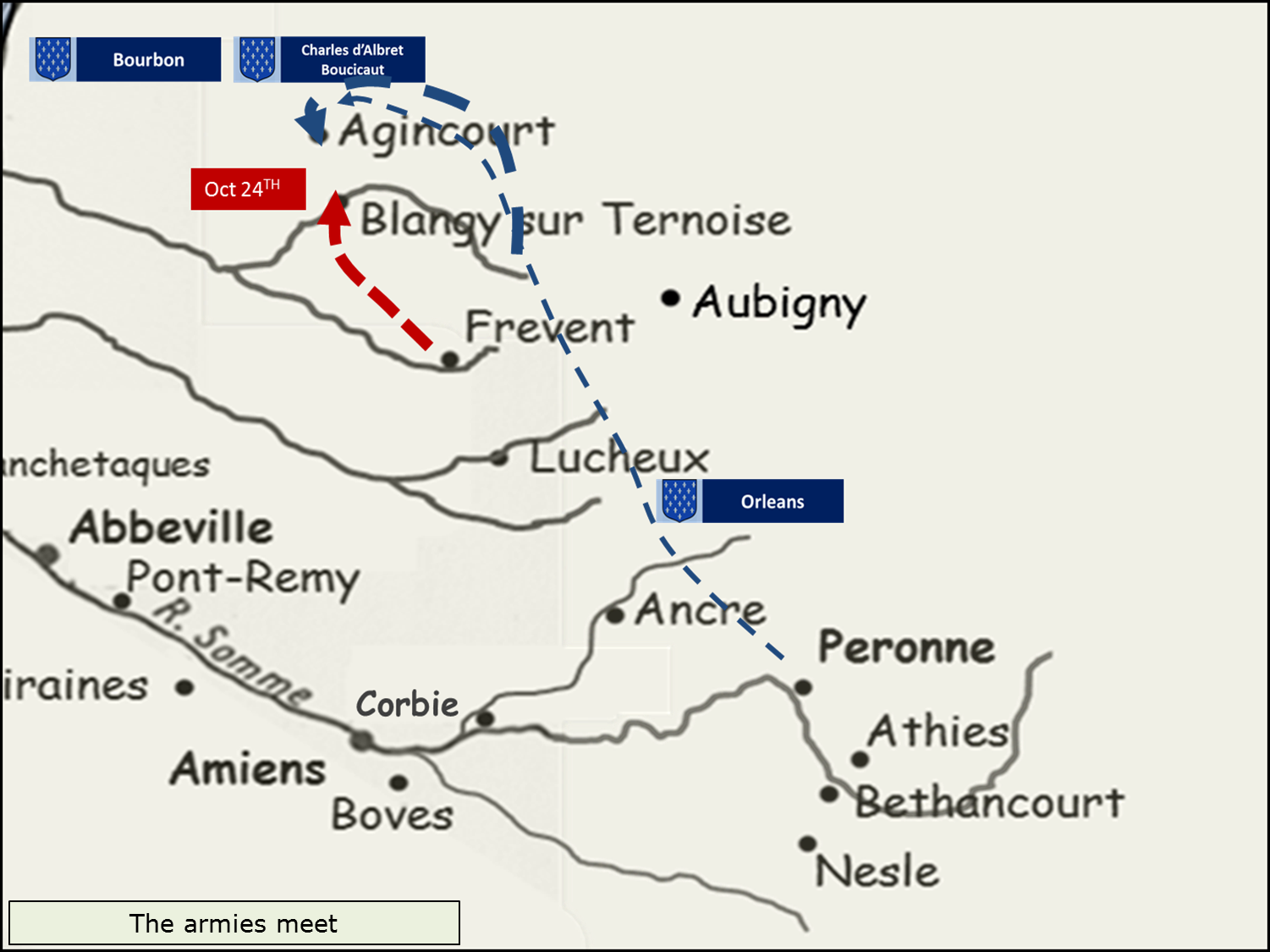
Wonderful job on the animated maps. The only slight change that could be made is that on slide 12, you list the French position as being on September 23 when I think that you meant October 23. Thanks for your hard work.
Thanks Luke. Irritatingly, my ability to change these has become lost in the mists of time, like a sort of classical declension from a Golden Age, like Charlton Heston find the statue of Liberty in the sand!